The following is an excerpt from: (2021) Rediscovering the Landscape at the Kampsville Locks. Poster presented at the 2021 Annual Midwest Archaeological Conference, East Lansing, Michigan. (Kenzie May, Jason L. King, Duncan P. McKinnon)

The Kampsville Locks site contains the remnants of the Kampsville Lock and Dam and associated row of Operator’s Houses located on the western back of the Illinois River. The site is south of the current Village of Kampsville in Calhoun County, Illinois.
It was one of four lock and dam systems built to improve navigability of the Illinois River and connect the Great Lakes to the Mississippi River for commerce and travel during the late 19th century (Figure 1). The lock and dam at Kampsville allowed the small village of Kampsville to flourish into a popular resort spot along the Illinois River. In 1938, the Kampsville Lock and Dam was removed from service and the site began to infill with alluvium that ultimately buried most of the permanent structural features. Since 2018, the Center for American Archeology has conducted archaeological and geophysical fieldwork to document the site and its importance to the history of the Village of Kampsville and Calhoun County.
KAMPSVILLE LOCKS (1893-1938)
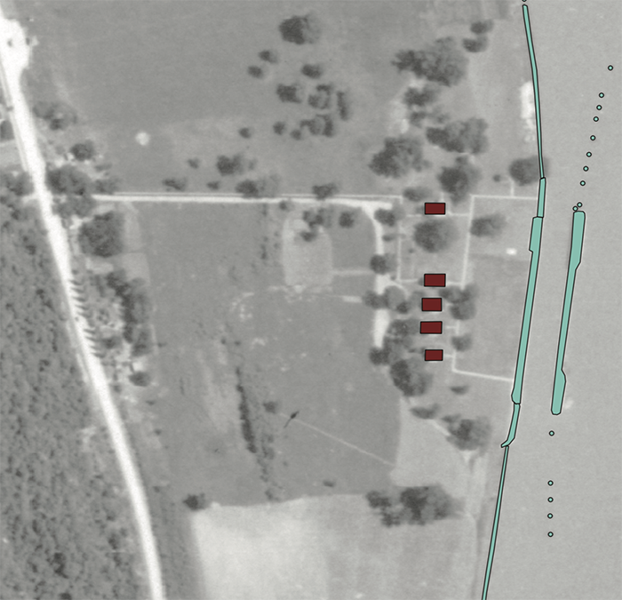
The federal government began constructing the lock and dam in 1880 with the locks opening on September 30, 1893. The dam was 1200 ft long and stretched from the east side of the river to the lock chamber located on the west side. The lock walls were built of limestone. The chamber was 350 ft long and 75 ft wide.
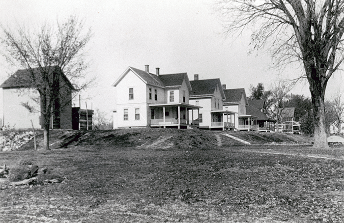
Five houses were constructed on the grounds, which were inhabited by lock operators and their families (Figure 2). Their location provided easy and immediate access to the locks. Houses were surrounded by open, grassy areas that served as a popular gathering place for tourists and villagers. Visitors would gather in these well-maintained areas to picnic and enjoy watching the vessels navigate through the lock chamber.
From its opening until 1938, the locks were a major contribution to the economic growth and tourism and transportation success at the Village of Kampsville. According to the U.S. Census records, the population of Kampsville increased dramatically during this time, beginning with 79 occupants in 1880 and growing to 487 by 1940. Restaurants, hotels, a movie house, ice cream confectionaries, livery stable, butcher, a button factory, and multiple blacksmith shops all operated alongside the lock and dam. The removal of the lock and dam in 1938 diverted river traffic away from the Village of Kampsville, in which population began to decrease steadily after 1950.


KAMPSVILLE LOCKS TODAY
The present landscape is a poor representation of its vibrant past. Today, the site is overgrown and unmaintained. Several episodes of flooding have infilled the lock channel and buried most fo the lock walls. The remaining house foundations, sidewalks, and basement features are also buried under alluvium. A small portion of the lock walls and the northern lock gate are still visible.
REMOTE SENSING RESULTS
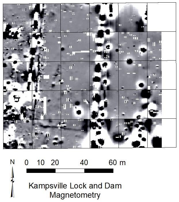
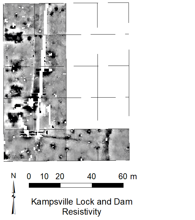
Both magnetic gradiometry and electrical resistivity data were collected at the site (Figure 3). Gradiometry data clearly identifies linear features that are associated with house foundations, buried sidewalks, and the walls of the lock. Resistivity data corroborates gradiometry data with the identification of four subsurface voids (cellars) that are now filled.


For more information:
| Cooley, Lyman E. 1914 The Illinois River: Physical Relations and the Removal of Navigation Dams with Supplement on the Waterway Relations of the Sanitary and Ship Canal of Chicago. Clohesey Co Printers, Chicago. Tweet, Ronald, D. 1983 History of Transportation on the Upper Mississippi and Illinois Rivers. U.S. Government Printing Office, Washington, D.C. Waldeuser, Lela 1974 The Ebb and Flow of the Folks You Knew in Kampsville. Kampsville Century Section, July #23. |